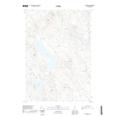
2021 Map of Alligator Lake
USGS Topo · Published 2021About this map
Alligator Lake anchors this part of Hancock County, surrounded by a complex network of glacial ponds and mountain ridges. The terrain is defined by prominent elevations such as Eagle Mtn, Jimmies Mtn, and Blackcap Mtn, which overlook the headwaters of the West Branch Narraguagus River. This landscape reflects a tradition of timber management and remote wilderness access, evident in the extensive grid of logging roads like Stud Mill Rd and Gould Brook Rd that traverse the ridges and connect the various water bodies. To the south, the topography descends toward Humpback Bog and the Lower Middle Branch Pond, illustrating the transition from steep mountain slopes to the low-lying wetlands and drainage basins characteristic of the Maine interior.
Find a feature on this map
68 named features on this map. Tap any name to fly to it.
Don’t see what you’re looking for? This feature index may not catch every label — zoom into the map to look around manually.
Map Details
Editions of this 2021 Alligator Lake Map
This is the sole edition of this map. No revisions or reprints were ever made.
Other maps of this area

1929 · Great Pond
USGS Topo · 1:48,000

1929 · Lead Mountain
USGS Topo · 1:48,000

1931 · Saponac
USGS Topo · 1:48,000

1932 · Nicatous Lake
USGS Topo · 1:48,000

1932 · Lead Mountain
USGS Topo · 1:62,500

1932 · Great Pond
USGS Topo · 1:62,500

1934 · Saponac
USGS Topo · 1:62,500

1934 · Nicatous Lake
USGS Topo · 1:62,500

1948 · Bangor
USGS Topo · 1:250,000

1954 · Millinocket
USGS Topo · 1:250,000