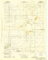
1945 Map of Alpine Butte
USGS Topo · Published 1945About this map
The Antelope Valley Indian Museum stands as a cultural landmark in this mid-1940s landscape, positioned near the foot of Piute Butte. The terrain is defined by a series of isolated formations rising from the desert floor, including Alpine Butte and the Lovejoy Buttes, where Lovejoy Springs and the ephemeral Lovejoy Lake provided critical water sources in an otherwise arid environment.
Find a feature on this map
22 named features on this map. Tap any name to fly to it.
Don’t see what you’re looking for? This feature index may not catch every label — zoom into the map to look around manually.
Map Details
Editions of this 1945 Alpine Butte Map
This is the sole edition of this map. No revisions or reprints were ever made.
Other maps of this area

1900 · Tujunga
USGS Topo · 1:62,500

1901 · Southern California Sheet No. 1
USGS Topo · 1:250,000

1903 · Rock Creek
USGS Topo · 1:62,500

1903 · San Antonio
USGS Topo · 1:62,500

1904 · Southern California Sheet No. 1
USGS Topo · 1:250,000

1915 · Elizabeth Lake
USGS Topo · 1:125,000

1917 · Elizabeth Lake
USGS Topo · 1:125,000

1930 · Joshua
USGS Topo · 1:24,000

1930 · Lovejoy Springs
USGS Topo · 1:24,000

1930 · Black Butte
USGS Topo · 1:24,000