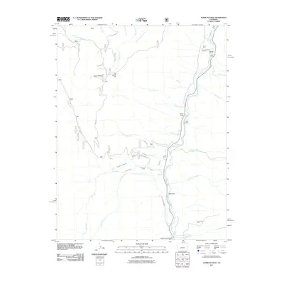
2011 Map of Alpine Plateau
USGS Topo · Published 2011About this map
Alpine Plateau and the high country of Gunnison County are defined by a network of ranching homesteads and water management infrastructure. The Lake Fork serves as a primary drainage for the area, joined by numerous gulches and creeks such as Spring Gulch and Dwyer Gulch. Settlement patterns are clustered around family-named landholdings, including Wilson Ranch, Thomas Ranch, and the Thompson Ranch.
Find a feature on this map
41 named features on this map. Tap any name to fly to it.
Don’t see what you’re looking for? This feature index may not catch every label — zoom into the map to look around manually.
Map Details
Editions of this 2011 Alpine Plateau Map
This is the sole edition of this map. No revisions or reprints were ever made.
Other maps of this area

1903 · Lake City
USGS Topo · 1:62,500

1905 · Lake City
USGS Topo · 1:62,500

1908 · Uncompahgre
USGS Topo · 1:125,000

1911 · Uncompahgre
USGS Topo · 1:125,000

1954 · Gateview
USGS Topo · 1:24,000

1956 · Montrose
USGS Topo · 1:250,000

1959 · Montrose
USGS Topo · 1:250,000

1960 · Montrose
USGS Topo · 1:250,000
1963 · Sheep Mountain
USGS Topo · 1:24,000
1963 · Lake City
USGS Topo · 1:24,000