
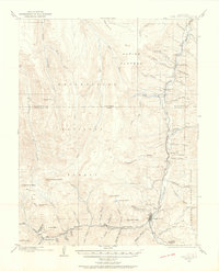
1903 Map of Lake City
USGS Topo · Published 1955About this map
Lake City stands as the industrial and social anchor of this high-elevation terrain, where the Gunnison River and Henson Creek converge. The landscape is defined by the heavy infrastructure of the mining era, notably the Hidden Treasure Mill and the Red Rover Mill located near Capitol City. These operations were serviced by the Denver and Rio Grande R. R., which pushed its tracks through difficult mountain passes to reach Kellogg Siding and Youman.
Find a feature on this map
82 named features on this map. Tap any name to fly to it.
Don’t see what you’re looking for? This feature index may not catch every label — zoom into the map to look around manually.
Map Details
Editions of this 1903 Lake City Map
2 editions found
Other maps of this area

1897 · Silverton
USGS Topo · 1:62,500

1901 · Silverton
USGS Topo · 1:62,500

1902 · Silverton
USGS Topo · 1:62,500

1902 · Ouray
USGS Topo · 1:62,500

1904 · Ouray
USGS Topo · 1:62,500

1905 · Lake City
USGS Topo · 1:62,500

1905 · San Cristobal
USGS Topo · 1:125,000

1907 · San Cristobal
USGS Topo · 1:125,000

1908 · Uncompahgre
USGS Topo · 1:125,000

1909 · Montrose
USGS Topo · 1:125,000