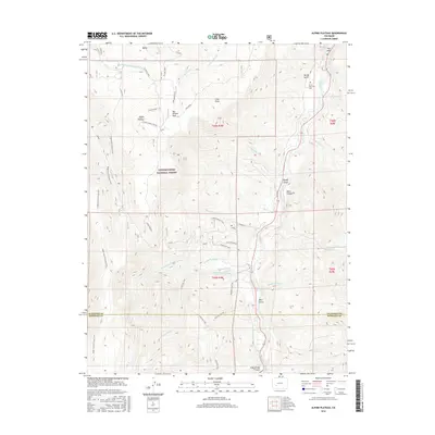
2016 Map of Alpine Plateau
USGS Topo · Published 2016About this map
The Alpine Plateau dominates this high-altitude landscape within the Uncompahgre National Forest, where the terrain is marked by a complex network of seasonal watercourses and man-made irrigation structures. Ranching history is central to this area, evidenced by the presence of Thompson Ranch and Ute Trail Ranch. Genealogists may find particular interest in the Nurse-Brownlee Cem, located near the Lake Fork of the Gunnison River.
Find a feature on this map
50 named features on this map. Tap any name to fly to it.
Don’t see what you’re looking for? This feature index may not catch every label — zoom into the map to look around manually.
Map Details
Editions of this 2016 Alpine Plateau Map
This is the sole edition of this map. No revisions or reprints were ever made.
Other maps of this area

1903 · Lake City
USGS Topo · 1:62,500

1905 · Lake City
USGS Topo · 1:62,500

1908 · Uncompahgre
USGS Topo · 1:125,000

1911 · Uncompahgre
USGS Topo · 1:125,000

1954 · Gateview
USGS Topo · 1:24,000

1956 · Montrose
USGS Topo · 1:250,000

1959 · Montrose
USGS Topo · 1:250,000

1960 · Montrose
USGS Topo · 1:250,000
1963 · Sheep Mountain
USGS Topo · 1:24,000
1963 · Lake City
USGS Topo · 1:24,000