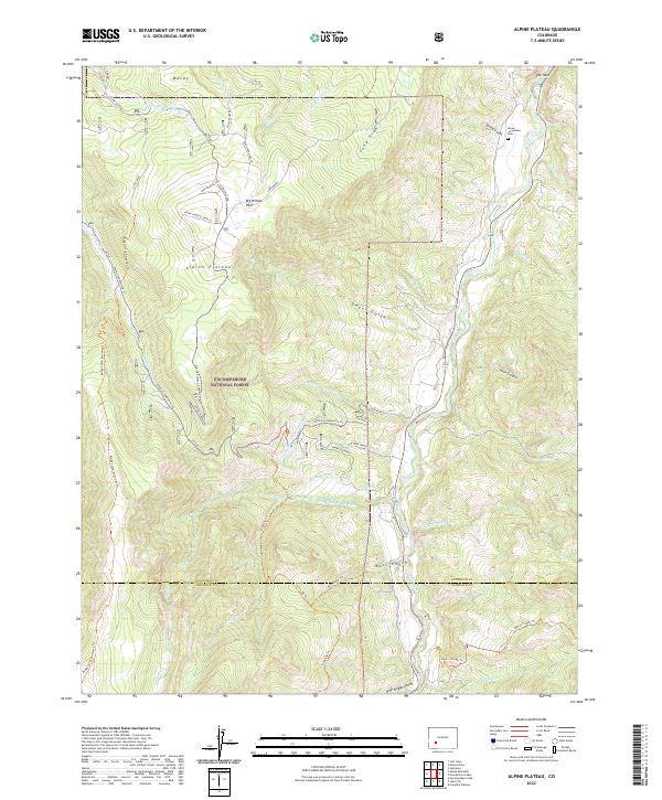
2022 Map of Alpine Plateau
USGS Topo · Published 2022About this map
Alpine Plateau dominates the high-country landscape of the Uncompahgre National Forest, where the terrain transitions across the Gunnison and Hinsdale county line. This region is defined by an intricate network of early ranching and water management, evidenced by the Youman Ditch, Copeland-Elk-Cr Ditch, and the irrigation systems serving Thompson Ranch and Ute Trail Ranch. The presence of the Nurse-Brownlee Cem near Spring Gulch provides a rare genealogical anchor in a landscape otherwise shaped by seasonal grazing and high-altitude movement.
Find a feature on this map
52 named features on this map. Tap any name to fly to it.
Don’t see what you’re looking for? This feature index may not catch every label — zoom into the map to look around manually.
Map Details
Editions of this 2022 Alpine Plateau Map
This is the sole edition of this map. No revisions or reprints were ever made.
Other maps of this area

1903 · Lake City
USGS Topo · 1:62,500

1905 · Lake City
USGS Topo · 1:62,500

1908 · Uncompahgre
USGS Topo · 1:125,000

1911 · Uncompahgre
USGS Topo · 1:125,000

1954 · Gateview
USGS Topo · 1:24,000

1956 · Montrose
USGS Topo · 1:250,000

1959 · Montrose
USGS Topo · 1:250,000

1960 · Montrose
USGS Topo · 1:250,000
1963 · Sheep Mountain
USGS Topo · 1:24,000
1963 · Lake City
USGS Topo · 1:24,000