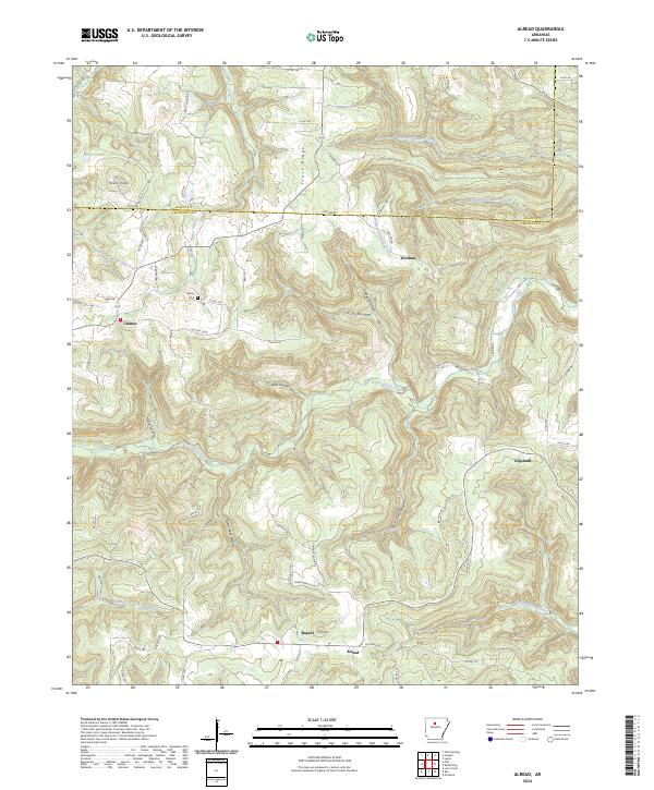
2024 Map of Alread
USGS Topo · Published 2024About this map
Archey Creek and its many winding tributaries define this portion of the Ozark landscape where the Searcy Co and Van Buren Co line is marked by Co Line Rd. Small, dispersed settlements like Chimes, Woolum, and Copeland are linked by a network of county roads and loops that navigate the complex system of hollows and ridges, including Lick Hollow and Trace Ridge. The terrain is characterized by significant elevation changes, notably at Reves Knob and Pine Mtn. In the south, the village of Alread sits near the headwaters of the South Fork Little Red River, while Liberty Cem serves as a central landmark for local genealogists tracking families across the township boundaries of t13n r16w and t12n r16w. The mapping of these drainages, such as North Castleberry Creek and Opossum Walk Creek, illustrates the drainage patterns that shaped early settlement in this region.
Find a feature on this map
77 named features on this map. Tap any name to fly to it.
Don’t see what you’re looking for? This feature index may not catch every label — zoom into the map to look around manually.
Map Details
Editions of this 2024 Alread Map
This is the sole edition of this map. No revisions or reprints were ever made.
Other maps of this area

1879 · Washington
USGS Topo · 1:62,500

1887 · Smyrna
USGS Topo · 1:62,500

1889 · Marshall #3
USGS Topo · 1:62,500

1892 · Marshall
USGS Topo · 1:125,000

1894 · Marshall
USGS Topo · 1:125,000

1901 · Marshall
USGS Topo · 1:125,000

1939 · Snowball
USGS Topo · 1:62,500

1940 · Smyrna
USGS Topo · 1:62,500

1941 · Snowball
USGS Topo · 1:62,500

1942 · Snowball
USGS Topo · 1:62,500