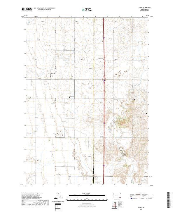
2021 Map of Alsen
USGS Topo · Published 2021About this map
Alsen and the neighboring rural communities of Hill Side and Greenfield anchor this southeastern South Dakota landscape along the border of Clay and Union counties. The terrain is defined by the winding course of Brule Cr, which creates a more varied topography in the eastern portion of the map compared to the strictly gridded section-line roads of the west. This agricultural corridor is dotted with significant sites for local history and genealogy, including Steadman Cem, Rockfield Cem, and the Roseni Lutheran Church Cem. The area around Hill Side contains recreational and natural management features such as the Brule Bottom Trl and the Mosey Meadow Multi-Use Trl, highlighting how the drainage of Brule Cr has shaped both the land use and the local road network, including the transition from 303rd St down to 311th St.
Find a feature on this map
31 named features on this map. Tap any name to fly to it.
Don’t see what you’re looking for? This feature index may not catch every label — zoom into the map to look around manually.
Map Details
Editions of this 2021 Alsen Map
This is the sole edition of this map. No revisions or reprints were ever made.
Other maps of this area

1897 · Canton
USGS Topo · 1:125,000

1898 · Elk Point
USGS Topo · 1:125,000

1900 · Canton
USGS Topo · 1:125,000

1901 · Elk Point
USGS Topo · 1:125,000

1907 · Elk Point
USGS Topo · 1:125,000

1955 · Sioux City
USGS Topo · 1:250,000

1955 · Sioux Falls
USGS Topo · 1:250,000

1958 · Sioux City
USGS Topo · 1:250,000

1958 · Sioux Falls
USGS Topo · 1:250,000

1959 · Sioux City
USGS Topo · 1:250,000
Featured Places
- Prairie Center Township, SD
- Garfield Township, SD
- Prairie Township, SD
- Spink Township, SD
- Glenwood Township, SD