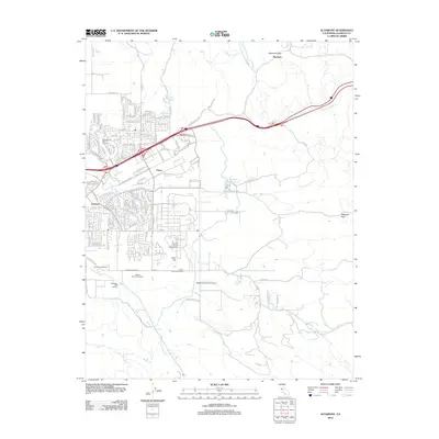
2012 Map of Altamont
USGS Topo · Published 2012About this map
Sandia National Laboratories anchors the central valley floor of this 2012 survey, marking a significant landscape of scientific research south of Ulmar. This region in Alameda County is defined by its transition from the dense residential developments of Trevarno and the Springtown district into the steep, rolling hills of the Altamont Pass. The map highlights a specialized agricultural economy, particularly the concentration of viticulture including Wente Brothers Winery, Concannon Winery, and Cedar Mountain Winery. Infrastructure such as the Meadowlark Field Airport and the complex network of roads like Altamont Pass Rd and N Vasco Rd illustrate the area's role as a vital transportation and energy corridor. Small water features like Frick Lake and Patterson Reservoir dot the arid terrain, while drainage systems including Arroyo Seco and Arroyo Mocho trace the natural topography of the eastern Livermore Valley.
Find a feature on this map
84 named features on this map. Tap any name to fly to it.
Don’t see what you’re looking for? This feature index may not catch every label — zoom into the map to look around manually.
Map Details
Editions of this 2012 Altamont Map
This is the sole edition of this map. No revisions or reprints were ever made.
Other maps of this area

1896 · Mt. Diablo
USGS Topo · 1:62,500

1898 · Mt. Diablo
USGS Topo · 1:62,500

1906 · Pleasanton
USGS Topo · 1:62,500

1907 · Tesla
USGS Topo · 1:62,500

1911 · Byron Hot Springs
USGS Topo · 1:31,680

1914 · Bethany
USGS Topo · 1:31,680

1916 · Byron Hot Springs
USGS Topo · 1:31,680

1916 · Byron
USGS Topo · 1:62,500

1916 · Midway
USGS Topo · 1:31,680

1940 · Byron
USGS Topo · 1:62,500