
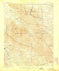
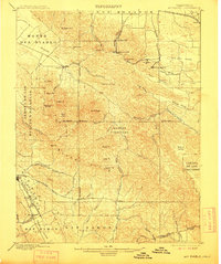
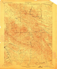
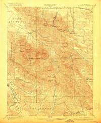
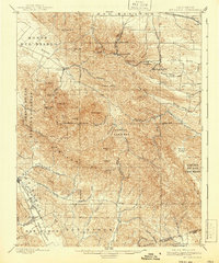
1898 Map of Mt. Diablo
USGS Topo · Published 1898About this map
Mt. Diablo dominates the central landscape of this late 19th-century survey, surrounded by the high peaks of North Peak and Eagle Pt. The northern slopes reveal a concentrated industrial cluster of coal-mining settlements, including Nortonville, Somersville, and Stewartville, which were vital to the region's early energy economy. The Star Mine sits near these communities, connected by a network of canyons like Markley Canyon and Perkins Canyon.
Find a feature on this map
72 named features on this map. Tap any name to fly to it.
Don’t see what you’re looking for? This feature index may not catch every label — zoom into the map to look around manually.
Map Details
Editions of this 1898 Mt. Diablo Map
7 editions found
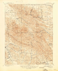
Other maps of this area

1896 · Carquinez Strait
USGS Topo · 1:62,500

1896 · Mt. Diablo
USGS Topo · 1:62,500

1897 · Concord
USGS Topo · 1:62,500

1898 · Karquines
USGS Topo · 1:62,500

1899 · Haywards
USGS Topo · 1:62,500

1901 · Karquines
USGS Topo · 1:62,500

1902 · Napa
USGS Topo · 1:125,000

1906 · Pleasanton
USGS Topo · 1:62,500

1907 · Tesla
USGS Topo · 1:62,500

1907 · Antioch
USGS Topo · 1:62,500