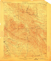
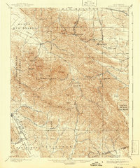
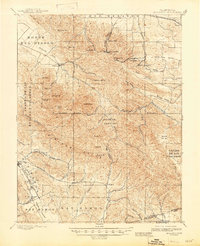
1898 Map of Mt. Diablo
USGS Topo · Published 1912About this map
Mt. Diablo dominates this late-nineteenth-century landscape, serving as the anchor for the region's topography and the literal intersection of the Base Line and Meridian. The map reveals a transition between the mining-heavy canyons to the north and the agricultural valleys to the west and south. Notable coal mining operations are evidenced by the Star Mine and the cluster of settlements including Nortonville, Somersville, and Stewartville, which were served by specialized rail lines like the Pittsburg R. R. and Empire R. R.
Find a feature on this map
66 named features on this map. Tap any name to fly to it.
Don’t see what you’re looking for? This feature index may not catch every label — zoom into the map to look around manually.
Map Details
Editions of this 1898 Mt. Diablo Map
7 editions found
Other maps of this area

1896 · Carquinez Strait
USGS Topo · 1:62,500

1896 · Mt. Diablo
USGS Topo · 1:62,500

1897 · Concord
USGS Topo · 1:62,500

1898 · Karquines
USGS Topo · 1:62,500

1898 · Mt. Diablo
USGS Topo · 1:62,500

1899 · Haywards
USGS Topo · 1:62,500

1901 · Karquines
USGS Topo · 1:62,500

1902 · Napa
USGS Topo · 1:125,000

1906 · Pleasanton
USGS Topo · 1:62,500

1907 · Tesla
USGS Topo · 1:62,500