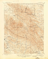
1898 Map of Mt. Diablo
USGS Topo · Published 1947About this map
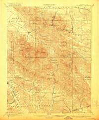
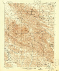
Mt. Diablo dominates this landscape, serving as the primary anchor for the Mt. Diablo Base Line and Mt. Diablo Meridian used to survey vast stretches of the American West. The northern slopes are defined by the presence of industrial coal-mining settlements like Nortonville, Somersville, and Stewartville, which were linked to the Delta by the Empire R. R. To the west, the village of Clayton sits at the foot of Mt. Zion, while the southern reaches showcase the early development of the San Ramon Valley with the rail-side towns of Danville and San Ramon. The rugged eastern canyons of Morgan Territory and Cañada de los Vaqueros offer a stark contrast to the emerging agricultural valleys, preserving the complex topography of the Black Hills and North Peak.
Find a feature on this map
73 named features on this map. Tap any name to fly to it.
Don’t see what you’re looking for? This feature index may not catch every label — zoom into the map to look around manually.
Map Details
Editions of this 1898 Mt. Diablo Map
7 editions found
Other maps of this area

1896 · Carquinez Strait
USGS Topo · 1:62,500

1896 · Mt. Diablo
USGS Topo · 1:62,500

1897 · Concord
USGS Topo · 1:62,500

1898 · Karquines
USGS Topo · 1:62,500

1898 · Mt. Diablo
USGS Topo · 1:62,500

1899 · Haywards
USGS Topo · 1:62,500

1901 · Karquines
USGS Topo · 1:62,500

1902 · Napa
USGS Topo · 1:125,000

1906 · Pleasanton
USGS Topo · 1:62,500

1907 · Tesla
USGS Topo · 1:62,500