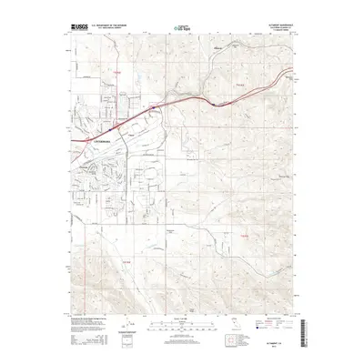
2015 Map of Altamont
USGS Topo · Published 2015About this map
Altamont Pass and Patterson Pass dominate this eastern edge of the Livermore Valley, where the terrain transitions into the high ridges of the Diablo Range. The map details a sophisticated network of water infrastructure, most notably the S Bay Aqueduct, which winds across the landscape alongside seasonal drainages like Arroyo Seco and Dry Cr. This area is defined by its strategic corridors, where roads and railways follow the natural gaps in the hills that have long connected the valley to the San Joaquin delta region. Smaller residential clusters such as Trevarno and Ulmar appear on the outskirts of Livermore, while established landmarks like Lone Hill and the seasonal Frick Lake serve as distinct topographic markers. To the south, the map rises toward Crane Ridge, illustrating the complex relief of the backcountry south of Tesla Road.
Find a feature on this map
141 named features on this map. Tap any name to fly to it.
Don’t see what you’re looking for? This feature index may not catch every label — zoom into the map to look around manually.
Map Details
Editions of this 2015 Altamont Map
This is the sole edition of this map. No revisions or reprints were ever made.
Other maps of this area

1896 · Mt. Diablo
USGS Topo · 1:62,500

1898 · Mt. Diablo
USGS Topo · 1:62,500

1906 · Pleasanton
USGS Topo · 1:62,500

1907 · Tesla
USGS Topo · 1:62,500

1911 · Byron Hot Springs
USGS Topo · 1:31,680

1914 · Bethany
USGS Topo · 1:31,680

1916 · Byron Hot Springs
USGS Topo · 1:31,680

1916 · Byron
USGS Topo · 1:62,500

1916 · Midway
USGS Topo · 1:31,680

1940 · Byron
USGS Topo · 1:62,500