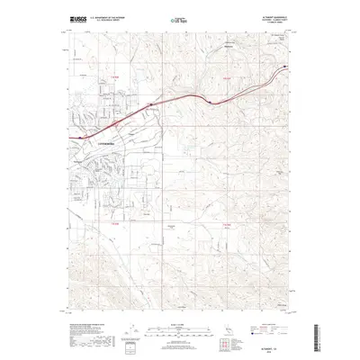
2018 Map of Altamont
USGS Topo · Published 2018About this map
Altamont Pass serves as the gateway between the coastal ranges and the Central Valley, a gap that has historically dictated the flow of transport and energy across California. This survey of the eastern Livermore Valley illustrates a landscape transitioning from the suburban expansion of Trevarno and Ulmar into the steep, rolling terrain of the Diablo Range. The critical infrastructure of the S Bay Aqueduct and Altamont Pass Rd snakes through the hills, following the natural contours that have guided travelers since the pioneer era. To the south, the open space of Meadowlark Field and the elevations of Crane Ridge overlook the winding drainage of Arroyo Mocho, while seasonal features like Frick Lake and Patterson Reservoir mark the local hydrology of this rain-shadowed region.
Find a feature on this map
180 named features on this map. Tap any name to fly to it.
Don’t see what you’re looking for? This feature index may not catch every label — zoom into the map to look around manually.
Map Details
Editions of this 2018 Altamont Map
This is the sole edition of this map. No revisions or reprints were ever made.
Other maps of this area

1896 · Mt. Diablo
USGS Topo · 1:62,500

1898 · Mt. Diablo
USGS Topo · 1:62,500

1906 · Pleasanton
USGS Topo · 1:62,500

1907 · Tesla
USGS Topo · 1:62,500

1911 · Byron Hot Springs
USGS Topo · 1:31,680

1914 · Bethany
USGS Topo · 1:31,680

1916 · Byron Hot Springs
USGS Topo · 1:31,680

1916 · Byron
USGS Topo · 1:62,500

1916 · Midway
USGS Topo · 1:31,680

1940 · Byron
USGS Topo · 1:62,500