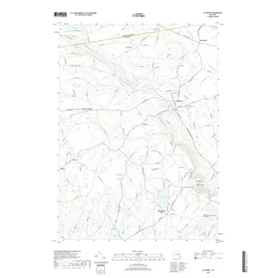
2019 Map of Altamont
USGS Topo · Published 2019About this map
Altamont sits at the foot of the dramatic escarpment where the Helderberg Mountains rise from the valley floor. This 2019 survey captures the transition from the rolling agricultural lands of the north to the elevated plateau of the south, marked by the prominent cliffside features of Indian Ladder and Horseshoe Lot. The landscape is dotted with small rural burial grounds, including the Ostrander Cem, Lainhart Cem, and Snyder Cem, which offer significant value for genealogical research in this part of Albany County.
Find a feature on this map
121 named features on this map. Tap any name to fly to it.
Don’t see what you’re looking for? This feature index may not catch every label — zoom into the map to look around manually.
Map Details
Editions of this 2019 Altamont Map
This is the sole edition of this map. No revisions or reprints were ever made.
Other maps of this area

1893 · Schenectady
USGS Topo · 1:62,500

1893 · Albany
USGS Topo · 1:62,500

1895 · Albany
USGS Topo · 1:62,500

1895 · Schenectady
USGS Topo · 1:62,500

1895 · Amsterdam
USGS Topo · 1:62,500

1898 · Schenectady
USGS Topo · 1:62,500

1898 · Albany
USGS Topo · 1:62,500

1900 · Berne
USGS Topo · 1:62,500

1903 · Berne
USGS Topo · 1:62,500

1927 · Albany
USGS Topo · 1:62,500