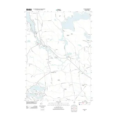
2012 Map of Alton
USGS Topo · Published 2012About this map
Alton Bay serves as a primary gateway to the southern reaches of Lake Winnipesaukee, anchoring a landscape defined by the drainage of the Merrymeeting River into the broader Lakes Region. In the early 21st century, the area shows a complex mix of historic village centers and modern recreation, evidenced by the cluster of camps and community landings like the Merrymeeting River Camping Community and Camp Mi-Ta-Na. The terrain is punctuated by significant elevations including Ragged Mountain and Prospect Mountain, while the industrial history of the waterways is preserved in names like Powder Mill Fish Hatchery and Ela Mill Rd. Residential developments around Locke Lake and the Locke Lake Airport contrast with the more traditional agricultural and forested lands near Stockbridge Corners and Davis.
Find a feature on this map
123 named features on this map. Tap any name to fly to it.
Don’t see what you’re looking for? This feature index may not catch every label — zoom into the map to look around manually.
Map Details
Editions of this 2012 Alton Map
This is the sole edition of this map. No revisions or reprints were ever made.
Other maps of this area

1909 · Winnepesaukee
USGS Topo · 1:62,500

1919 · Gilmanton
USGS Topo · 1:62,500

1919 · Alton
USGS Topo · 1:62,500

1927 · Gilmanton
USGS Topo · 1:62,500

1928 · Wolfeboro
USGS Topo · 1:62,500

1949 · Portland
USGS Topo · 1:250,000

1956 · Winnipesaukee
USGS Topo · 1:62,500

1956 · Portland
USGS Topo · 1:250,000

1957 · Alton
USGS Topo · 1:62,500
1957 · Gilmanton
USGS Topo · 1:62,500