
1958 Map of Alturas
USGS Topo · Published 1958About this map
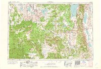
Alturas serves as the hub of this high-desert region in the late 1950s, situated at the junction of the Pit River and major transit corridors through the Modoc National Forest. The landscape is defined by its massive volcanic and lacustrine features, from the jagged Lava Beds National Monument and Glass Mountain to the expansive waters of Goose Lake and Tule Lake. This era shows a complex water management and wildlife conservation network, evidenced by the Lower Klamath National Wildlife Refuge and Clear Lake Reservoir. Along the eastern border, the Warner Mountains rise sharply above the Surprise Valley, where isolated settlements like Cedarville and Eagleville persist. The map also traces the vital rail lines of the Southern Pacific and Great Northern, which historically linked these remote timber and ranching communities to broader markets.
Find a feature on this map
82 named features on this map. Tap any name to fly to it.
Don’t see what you’re looking for? This feature index may not catch every label — zoom into the map to look around manually.
Map Details
Editions of this 1958 Alturas Map
2 editions found
Other maps of this area

1886 · Alturas
USGS Topo · 1:250,000

1886 · Honey Lake
USGS Topo · 1:250,000

1886 · Lassen Peak
USGS Topo · 1:250,000

1886 · Modoc Lava Bed
USGS Topo · 1:250,000

1886 · Shasta
USGS Topo · 1:250,000

1886 · Granite Range
USGS Topo · 1:250,000

1889 · Klamath
USGS Topo · 1:250,000

1889 · Long Valley
USGS Topo · 1:250,000

1890 · Red Bluff
USGS Topo · 1:250,000

1891 · Honey Lake
USGS Topo · 1:250,000