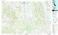
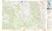
1983 Map of Alturas
USGS Topo · Published 1983About this map
The Pit River system, including its north and south forks, drains the high plateau of Northeastern California in this 1983 topographic study. The city of Alturas serves as the regional hub at the confluence of these waterways, positioned near the Modoc National Wildlife Refuge. The landscape is dominated by the massive Warner Mountains, which separate the river valleys from the arid Great Basin terrain to the east, where the Upper Alkali Lake, Middle Alkali Lake, and Lower Alkali Lake chain parallels the Nevada border. Smaller settlements such as Likely, Madeline, and Eagleville are connected by a network of roads and the Southern Pacific railroad line. Large protected areas, including the Modoc National Forest and the South Warner Wilderness, illustrate the region's commitment to land conservation and wildlife management during the late twentieth century.
Find a feature on this map
31 named features on this map. Tap any name to fly to it.
Don’t see what you’re looking for? This feature index may not catch every label — zoom into the map to look around manually.
Map Details
Editions of this 1983 Alturas Map
2 editions found
Other maps of this area

1886 · Alturas
USGS Topo · 1:250,000

1886 · Honey Lake
USGS Topo · 1:250,000

1886 · Lassen Peak
USGS Topo · 1:250,000

1886 · Modoc Lava Bed
USGS Topo · 1:250,000

1886 · Granite Range
USGS Topo · 1:250,000

1889 · Long Valley
USGS Topo · 1:250,000

1891 · Honey Lake
USGS Topo · 1:250,000

1892 · Modoc Lava-Bed
USGS Topo · 1:250,000

1892 · Lassen Peak
USGS Topo · 1:250,000

1892 · Alturas
USGS Topo · 1:250,000