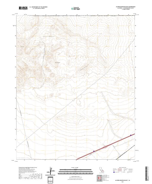
2021 Map of Alvord Mountain East
USGS Topo · Published 2021About this map
Alvord Mountain dominates this portion of the northern Mojave Desert, where the high ground of Alvord Peak and the drainage of Spanish Canyon define a landscape of complex topography. The map illustrates the transition from the steep elevations of Clews Ridge down to the arid flats traversed by modern infrastructure. These desert basins are bounded by the Public Land Survey System grids of T12N R4E and T11N R4E, showing how formal land divisions overlay this remote terrain. Along the southern margin, the corridor of Yermo Rd and the junction of Field Rd represent the primary transit arteries connecting these desert reaches to the broader San Bernardino County network, while Alvord Mountain Rd provides access deep into the mountain interior.
Find a feature on this map
13 named features on this map. Tap any name to fly to it.
Don’t see what you’re looking for? This feature index may not catch every label — zoom into the map to look around manually.
Map Details
Editions of this 2021 Alvord Mountain East Map
This is the sole edition of this map. No revisions or reprints were ever made.
Other maps of this area

1933 · Avawatz Mountains
USGS Topo · 1:250,000

1947 · Trona
USGS Topo · 1:250,000

1948 · Trona
USGS Topo · 1:250,000

1948 · Alvord Mountain
USGS Topo · 1:62,500

1948 · Cave Mountain
USGS Topo · 1:62,500

1951 · Cave Mountain
USGS Topo · 1:62,500

1951 · Alvord Mountain
USGS Topo · 1:62,500

1953 · San Bernardino
USGS Topo · 1:250,000

1953 · Trona
USGS Topo · 1:250,000

1955 · Newberry
USGS Topo · 1:62,500