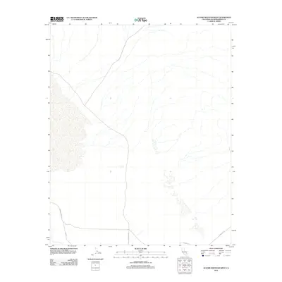
2012 Map of Alvord Mountain West
USGS Topo · Published 2012About this map
The arid expanses of San Bernardino County are defined here by a sparse network of roads and desert washes. Central to this landscape is Coyote Lake Rd, which strikes a north-south line through the open terrain, eventually intersecting with Novato St and Powerline Rd in the southern portion of the quadrangle. To the west, Paradise Springs Rd and Sand Rd provide access through the alluvial fans and drainage patterns that dominate the topography. This 2012 survey highlights the minimal human footprint in the region, focusing on these critical access routes that serve as the primary landmarks for navigation and land use in this desert environment.
Find a feature on this map
5 named features on this map. Tap any name to fly to it.
Don’t see what you’re looking for? This feature index may not catch every label — zoom into the map to look around manually.
Map Details
Editions of this 2012 Alvord Mountain West Map
This is the sole edition of this map. No revisions or reprints were ever made.
Other maps of this area

1933 · Avawatz Mountains
USGS Topo · 1:250,000

1947 · Trona
USGS Topo · 1:250,000

1948 · Trona
USGS Topo · 1:250,000

1948 · Alvord Mountain
USGS Topo · 1:62,500

1948 · Lane Mountain
USGS Topo · 1:62,500

1951 · Alvord Mountain
USGS Topo · 1:62,500

1951 · Lane Mountain
USGS Topo · 1:62,500

1953 · San Bernardino
USGS Topo · 1:250,000

1953 · Yermo
USGS Topo · 1:24,000

1953 · Trona
USGS Topo · 1:250,000