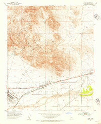
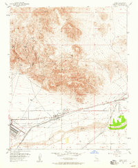
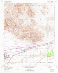
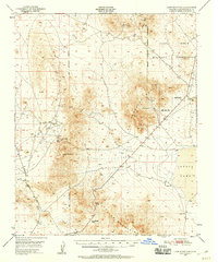
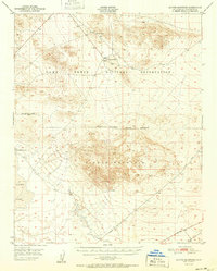
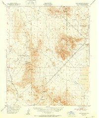
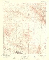
1953 Map of Yermo
USGS Topo · Published 1954About this map
The Calico Mountains dominate this 1953 landscape, where the Mojave Desert's mining history meets mid-century military expansion. At the base of the mountains lies Yermo, a vital transit point along the Union Pacific railroad, while the extensive Yermo Marine Base (Barstow Annex) and nearby Naval Res signify the area's strategic importance during the early Cold War. The map preserves the fading traces of the Silver Rush, marking the site of Bismarck and the settlement of Calico, alongside numerous Prospects and the St Louis Mine. Geologic and local landmarks like Kramer Arch and Chimney Rock break the rugged terrain of Odessa Canyon and Wall Street Canyon. This survey captures a moment when the regional economy was transitioning from its hard-rock mining roots toward large-scale military logistics and rail infrastructure along the Mojave River.
Find a feature on this map
31 named features on this map. Tap any name to fly to it.
Don’t see what you’re looking for? This feature index may not catch every label — zoom into the map to look around manually.
Map Details
Editions of this 1953 Yermo Map
3 editions found
Other maps of this area

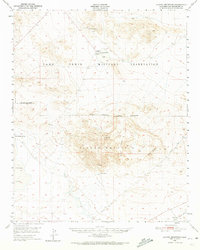
1933 · Avawatz Mountains
USGS Topo · 1:250,000

1947 · Trona
USGS Topo · 1:250,000

1948 · Trona
USGS Topo · 1:250,000
1948 · Alvord Mountain
USGS Topo · 1:62,500
1948 · Lane Mountain
USGS Topo · 1:62,500
1951 · Alvord Mountain
USGS Topo · 1:62,500
1951 · Lane Mountain
USGS Topo · 1:62,500

1953 · San Bernardino
USGS Topo · 1:250,000

1953 · Trona
USGS Topo · 1:250,000
1953 · Nebo
USGS Topo · 1:24,000