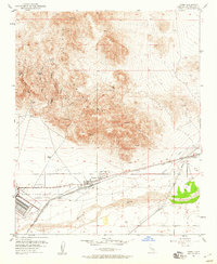
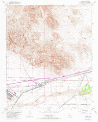
1953 Map of Yermo
USGS Topo · Published 1960About this map
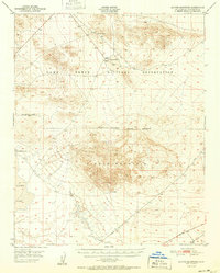
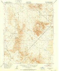
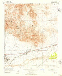
The Calico Mountains dominate the northern landscape of this survey, revealing a network of canyons and historic mining remnants such as the St Louis Mine and the Bismarck (Site). The terrain transitions from these high peaks, including Calico Peak and Chimney Rock, down to the broad wash of the Mojave River. This geological contrast highlights the region's development, where mineral extraction in the uplands met the essential transport and military corridors on the valley floor.
Find a feature on this map
26 named features on this map. Tap any name to fly to it.
Don’t see what you’re looking for? This feature index may not catch every label — zoom into the map to look around manually.
Map Details
Editions of this 1953 Yermo Map
3 editions found
Other maps of this area

1933 · Avawatz Mountains
USGS Topo · 1:250,000

1947 · Trona
USGS Topo · 1:250,000

1948 · Trona
USGS Topo · 1:250,000
1948 · Alvord Mountain
USGS Topo · 1:62,500
1948 · Lane Mountain
USGS Topo · 1:62,500
1951 · Alvord Mountain
USGS Topo · 1:62,500
1951 · Lane Mountain
USGS Topo · 1:62,500

1953 · San Bernardino
USGS Topo · 1:250,000
1953 · Yermo
USGS Topo · 1:24,000

1953 · Trona
USGS Topo · 1:250,000