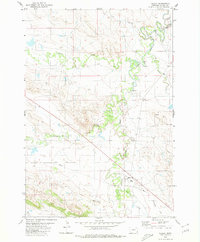
1980 Map of Alzada
USGS Topo · Published 1980About this map
The Little Missouri River snakes through the high plains of Carter County, Montana, providing the primary drainage for a series of seasonal tributaries. The settlement of Alzada serves as the focal point of this landscape, situated near the confluence of several waterways including Arkansas Creek and Willow Creek. This 1980 survey captures the community infrastructure of the era, notably the Rodeo Ground and a Gaging Sta along the riverbanks.
Find a feature on this map
16 named features on this map. Tap any name to fly to it.
Don’t see what you’re looking for? This feature index may not catch every label — zoom into the map to look around manually.
Map Details
Editions of this 1980 Alzada Map
This is the sole edition of this map. No revisions or reprints were ever made.
Other maps of this area

1901 · Aladdin
USGS Topo · 1:125,000

1903 · Aladdin
USGS Topo · 1:125,000

1905 · Devils Tower
USGS Topo · 1:125,000

1954 · Ekalaka
USGS Topo · 1:250,000

1954 · Gillette
USGS Topo · 1:250,000

1955 · Gillette
USGS Topo · 1:250,000

1956 · Ekalaka
USGS Topo · 1:250,000

1957 · Mona
USGS Topo · 1:62,500

1957 · Seely
USGS Topo · 1:62,500

1958 · Gillette
USGS Topo · 1:250,000