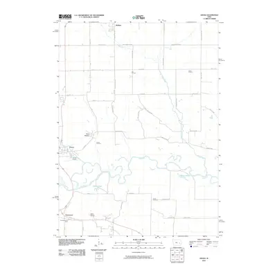
2010 Map of Amana
USGS Topo · Published 2010About this map
East Amana, Amana, and Homestead are the primary settlements on this landscape, reflecting the distinctive communal heritage of the Iowa County area. The meandering Iowa River dominates the central topography, creating a series of backwaters including Holdens Pond and Matson Pond. This 2010 survey shows the intersection of traditional agricultural patterns and modern infrastructure, with the Amana Airport situated just east of the main village. For genealogists and local historians, the map is particularly useful for locating numerous burial sites, such as the Hala Cemetery in the north and the Spicer-Spooner Cemetery further south. The drainage patterns of Knapp Creek and Rhine Creek further define the local environment, while the Homestead Post Office marks a key focal point for the southernmost community.
Find a feature on this map
45 named features on this map. Tap any name to fly to it.
Don’t see what you’re looking for? This feature index may not catch every label — zoom into the map to look around manually.
Map Details
Editions of this 2010 Amana Map
This is the sole edition of this map. No revisions or reprints were ever made.
Other maps of this area

1887 · Cedar Rapids
USGS Topo · 1:62,500

1888 · Amana
USGS Topo · 1:62,500

1889 · Amana
USGS Topo · 1:62,500

1891 · Oxford
USGS Topo · 1:62,500

1891 · Cedar Rapids
USGS Topo · 1:62,500

1891 · Iowa City
USGS Topo · 1:62,500

1894 · Oxford
USGS Topo · 1:62,500

1899 · Amana
USGS Topo · 1:62,500

1903 · Fairfax
USGS Topo · 1:125,000

1938 · Iowa City
USGS Topo · 1:62,500