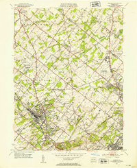
1952 Map of Ambler
USGS Topo · Published 1953About this map
Ambler and its surrounding townships in Montgomery and Bucks counties show a landscape transitioning from rural estate acreage to postwar suburban development in the early 1950s. The bustling street grid of Ambler is flanked by historic institutions like the Gwynedd-Mercy Junior College Academy and the Pennsylvania School of Horticulture. To the east, the massive footprint of the U S Naval Air Station (Willow Grove) and nearby Gloster Airport signal the region’s mid-century aviation significance. The map traces the winding paths of Wissahickon Creek and Little Neshaminy Creek, which cut through a terrain dotted with private clubs like the Oak Terrace Country Club and family-named cemeteries such as Whitcomb Cem and Rose Valley Cem. Transportation corridors like the Reading and Pennsylvania railroads, alongside the historic Bethlehem Pike, underscore the area's long-standing role as a gateway between Philadelphia and the Pennsylvania interior.
Find a feature on this map
81 named features on this map. Tap any name to fly to it.
Don’t see what you’re looking for? This feature index may not catch every label — zoom into the map to look around manually.
Map Details
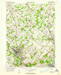
Editions of this 1952 Ambler Map
2 editions found
Other maps of this area

1888 · Quakertown
USGS Topo · 1:62,500

1890 · Doylestown
USGS Topo · 1:62,500

1890 · Quakertown
USGS Topo · 1:62,500

1891 · Doylestown
USGS Topo · 1:62,500

1893 · Germantown
USGS Topo · 1:62,500

1894 · Quakertown
USGS Topo · 1:62,500

1894 · Norristown
USGS Topo · 1:62,500

1894 · Germantown
USGS Topo · 1:62,500

1895 · Norristown
USGS Topo · 1:62,500

1896 · Germantown
USGS Topo · 1:62,500
Featured Places
- Abington Township, PA
- Warminster Township, PA
- Horsham Township, PA
- Warrington Township, PA
- Whitemarsh Township, PA