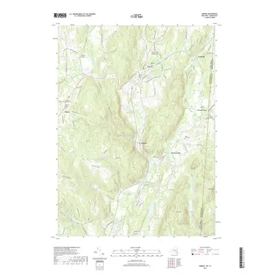
2019 Map of Amenia
USGS Topo · Published 2019About this map
Amenia and its surrounding hamlets occupy a valley landscape defined by the Tenmile River and Webatuck Creek, where the eastern border of New York meets Connecticut. This 2019 survey documents a region steeped in early settlement history, evidenced by a high density of small, named cemeteries such as the Amenia Burying Ground, the Separate Burying Ground, and the Northrup Burial Ground. The village of Wassaic serves as a local hub near the confluence of Wassaic Creek and the river, while smaller clusters like Lithgow and Leedsville anchor the outlying agricultural and upland areas. Cultural landmarks like the Red Meeting House near the Amenia Island Cemetery reflect the long-standing community structures in Dutchess County. The terrain transitions from the depths of Turkey Hollow to prominent elevations at Cobble Mountain and East Mountain, illustrating the physical geography that shaped the placement of early roads and homesteads.
Find a feature on this map
88 named features on this map. Tap any name to fly to it.
Don’t see what you’re looking for? This feature index may not catch every label — zoom into the map to look around manually.
Map Details
Editions of this 2019 Amenia Map
This is the sole edition of this map. No revisions or reprints were ever made.
Other maps of this area

1892 · Cornwall
USGS Topo · 1:62,500

1892 · New Milford
USGS Topo · 1:62,500

1893 · New Milford
USGS Topo · 1:62,500

1893 · Cornwall
USGS Topo · 1:62,500

1893 · Clove
USGS Topo · 1:62,500

1894 · Clove
USGS Topo · 1:62,500

1898 · Clove
USGS Topo · 1:62,500

1899 · Millbrook
USGS Topo · 1:62,500

1901 · Clove
USGS Topo · 1:62,500

1902 · Millbrook
USGS Topo · 1:62,500