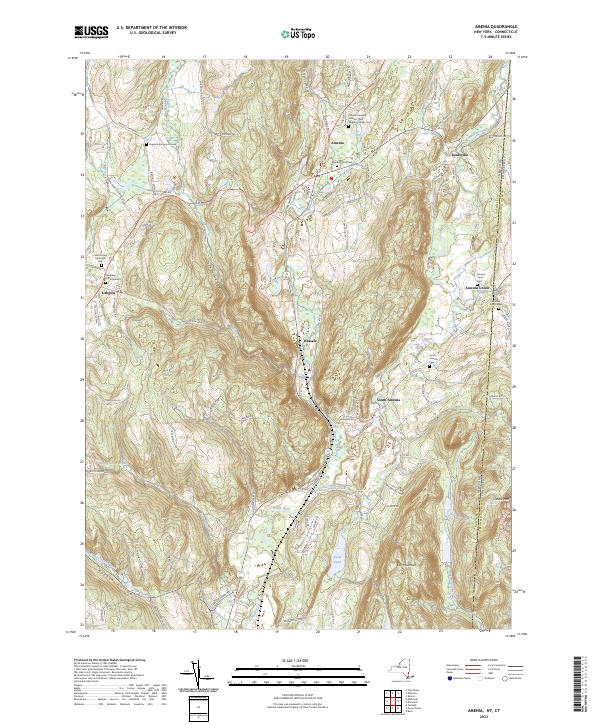
2023 Map of Amenia
USGS Topo · Published 2023About this map
Amenia and its surrounding hamlets occupy a dramatic landscape defined by the north-south corridors of the Taconic Mountains. This modern survey illustrates the persistent agricultural and village patterns of eastern Dutchess County, where the Tenmile River and Wassaic Creek carve through steep valleys. The area is notable for its concentration of early burial sites, including the Amenia Burying Ground - Red Meeting House Cem and the Separate Burying Ground, which serve as vital markers of colonial-era settlement near the New York-Connecticut border. To the west, the deep indentation of Turkey Hollow separates the main valley from the high ground near Lithgow. The map also captures the distinct layout of Wassaic and South Amenia, showing how local infrastructure like Depot Hill Rd and Railroad Ave continues to follow the historic paths of commerce and transit along the valley floor.
Find a feature on this map
93 named features on this map. Tap any name to fly to it.
Don’t see what you’re looking for? This feature index may not catch every label — zoom into the map to look around manually.
Map Details
Editions of this 2023 Amenia Map
This is the sole edition of this map. No revisions or reprints were ever made.
Other maps of this area

1892 · Cornwall
USGS Topo · 1:62,500

1892 · New Milford
USGS Topo · 1:62,500

1893 · New Milford
USGS Topo · 1:62,500

1893 · Cornwall
USGS Topo · 1:62,500

1893 · Clove
USGS Topo · 1:62,500

1894 · Clove
USGS Topo · 1:62,500

1898 · Clove
USGS Topo · 1:62,500

1899 · Millbrook
USGS Topo · 1:62,500

1901 · Clove
USGS Topo · 1:62,500

1902 · Millbrook
USGS Topo · 1:62,500