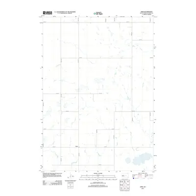
2012 Map of Ames
USGS Topo · Published 2012About this map
Ames serves as the focal point for this rural Hand County landscape, where the prairie grid is meticulously defined by a network of numbered section roads. The terrain is characterized by numerous small, scattered wetlands and depressions typical of the Missouri Coteau region. In the southeastern portion of the quadrangle, Wall Lake stands out as the most significant water feature, anchoring the local hydrology. The road system, including 215th St and 355th Ave, reveals the expansive agricultural partitioning of the land. This survey provides a clear view of the sparse settlement patterns in central South Dakota, where open space and natural basins predominate over developed infrastructure.
Find a feature on this map
17 named features on this map. Tap any name to fly to it.
Don’t see what you’re looking for? This feature index may not catch every label — zoom into the map to look around manually.
Map Details
Editions of this 2012 Ames Map
This is the sole edition of this map. No revisions or reprints were ever made.
Other maps of this area

1949 · Vayland SW
USGS Topo · 1:24,000

1950 · Vayland NW
USGS Topo · 1:24,000

1951 · Vayland SW
USGS Topo · 1:24,000

1953 · Huron
USGS Topo · 1:250,000

1954 · Huron
USGS Topo · 1:250,000

1973 · Ames
USGS Topo · 1:24,000

1973 · Miller Dale Colony SW
USGS Topo · 1:24,000

1973 · Big Bend Dam 4 NW
USGS Topo · 1:24,000

1973 · Big Bend Dam 4 NE
USGS Topo · 1:24,000
1973 · Mittelstedt Slough
USGS Topo · 1:24,000