
1973 Map of Big Bend Dam 4 NW
USGS Topo · Published 1976About this map
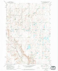
Old Indian Treaty Boundary slices vertically across this landscape, marking a legacy of land division in the Dakota Territory. Surveyed in the early 1970s, the terrain is defined by the winding course of Elm Creek and Sand Cr, which drain through a prairie landscape dotted with small glacial depressions and wetlands. The rural character of the region is anchored by the Prairie Center Sch and scattered agricultural developments across the townships of Como and Mon Damin. The map reveals the intricate network of section lines and fence lines, which show the structured settlement pattern typical of the High Plains. While largely a pastoral setting, industrial activity is noted by the presence of a Gravel Pit, providing a grounded look at the local economy during this era of Buffalo and Hand County history.
Find a feature on this map
9 named features on this map. Tap any name to fly to it.
Don’t see what you’re looking for? This feature index may not catch every label — zoom into the map to look around manually.
Map Details
Editions of this 1973 Big Bend Dam 4 NW Map
2 editions found
Other maps of this area

1953 · Huron
USGS Topo · 1:250,000

1954 · Huron
USGS Topo · 1:250,000

1966 · Big Bend Dam NE
USGS Topo · 1:24,000

1966 · Big Bend Dam SE
USGS Topo · 1:24,000

1973 · Big Bend Dam 4 SE
USGS Topo · 1:24,000

1973 · Ames
USGS Topo · 1:24,000

1973 · Miller Dale Colony SW
USGS Topo · 1:24,000

1973 · Macs Corner SE
USGS Topo · 1:24,000

1973 · Big Bend Dam 4 NE
USGS Topo · 1:24,000
1973 · Big Bend Dam 4 SW
USGS Topo · 1:24,000