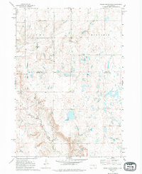
1973 Map of Prairie Center School
USGS Topo · Published 1994About this map
The Old Indian Treaty Boundary carves a diagonal line across this 1973 survey of central South Dakota, marking a significant historical division between Buffalo and Hand counties. The landscape is defined by the winding course of Elm Creek and a network of agricultural fence and field lines that characterize the Como and Mondamin townships. At the heart of this rural community stands the Prairie Center Sch, a vital local landmark for genealogists and regional historians. The map also documents industrial activity in the area through several Gravel Pits, illustrating the intersection of physical geography and human resource extraction in the Great Plains during the early 1970s.
Find a feature on this map
7 named features on this map. Tap any name to fly to it.
Don’t see what you’re looking for? This feature index may not catch every label — zoom into the map to look around manually.
Map Details
Editions of this 1973 Prairie Center School Map
2 editions found
Other maps of this area

1953 · Huron
USGS Topo · 1:250,000

1954 · Huron
USGS Topo · 1:250,000

1966 · Big Bend Dam NE
USGS Topo · 1:24,000

1966 · Big Bend Dam SE
USGS Topo · 1:24,000

1973 · Big Bend Dam 4 SE
USGS Topo · 1:24,000

1973 · Ames
USGS Topo · 1:24,000

1973 · Miller Dale Colony SW
USGS Topo · 1:24,000

1973 · Big Bend Dam 4 NW
USGS Topo · 1:24,000

1973 · Macs Corner SE
USGS Topo · 1:24,000

1973 · Big Bend Dam 4 NE
USGS Topo · 1:24,000