2023 Map of Ames West
USGS Topo · Published 2023About this map
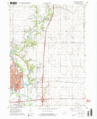
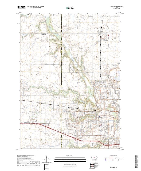
The Iowa State University campus serves as the cultural and geographical anchor of the landscape west of Ames, where the urban grid meets the agricultural heart of Story County. This 2023 survey documents a complex network of recreational and commuter infrastructure, including the Ioway Creek Path Trail and Ada Hayden Park Trail, which follow the natural contours of Ioway Creek and its various tributaries. The map details the transition from the densely developed university grounds near Laverne Lake to the outlying settlements of Ontario and Gilbert.
Find a feature on this map
66 named features on this map. Tap any name to fly to it.
Don’t see what you’re looking for? This feature index may not catch every label — zoom into the map to look around manually.
Map Details
Editions of this 2023 Ames West Map
This is the sole edition of this map. No revisions or reprints were ever made.
Historical Maps of Schilletter-University Village Through Time
7 maps found