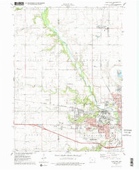
1975 Map of Ames West
USGS Topo · Published 1978About this map
Iowa State University anchors the southeastern corner of this mid-1970s survey, showing the campus footprint alongside the ISU Arboretum and the Ames Laboratory Research Reactor. The transition from the urban grid of Ames to the surrounding agricultural landscape is clearly defined, with the Chicago and North Western railroad corridor cutting through the terrain. To the west and north, smaller settlements like Ontario and Gilbert maintain their distinct identities, while the Iowa State University Experimental Farm illustrates the region's academic and agricultural integration.
Find a feature on this map
67 named features on this map. Tap any name to fly to it.
Don’t see what you’re looking for? This feature index may not catch every label — zoom into the map to look around manually.
Map Details
Editions of this 1975 Ames West Map
2 editions found

Other maps of this area

1911 · Madrid
USGS Topo · 1:62,500

1911 · Slater
USGS Topo · 1:62,500

1912 · Ames
USGS Topo · 1:62,500

1913 · Slater
USGS Topo · 1:62,500

1914 · Madrid
USGS Topo · 1:62,500

1914 · Ames
USGS Topo · 1:62,500

1916 · Boone
USGS Topo · 1:62,500

1954 · Waterloo
USGS Topo · 1:250,000

1954 · Des Moines
USGS Topo · 1:250,000

1955 · Waterloo
USGS Topo · 1:250,000