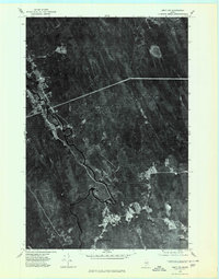
1975 Map of Amity SW
USGS Topo · Published 1980About this map
The Mattawamkeag River snakes through the dense woodland of southern Aroostook County, serving as the primary geographic corridor for this region in the mid-1970s. This orthophotoquad captures a landscape of intense forest cover punctuated by the clearing at Haynesville and the small settlements of Selden and North Bancroft. Unlike standard topographic maps, this imagery reveals the specific textures of the timberland, showing the network of logging roads and natural drainage patterns like Skagrock Brook and the East Branch. The prominence of Mitchell Mountain in the northwest and the clear waters of Faulkner Lake near the eastern border anchor the varied terrain of these North Woods communities during a period of steady industrial forest use.
Find a feature on this map
8 named features on this map. Tap any name to fly to it.
Don’t see what you’re looking for? This feature index may not catch every label — zoom into the map to look around manually.
Map Details
Editions of this 1975 Amity SW Map
This is the sole edition of this map. No revisions or reprints were ever made.
Other maps of this area

1940 · Danforth
USGS Topo · 1:62,500

1940 · Amity
USGS Topo · 1:62,500

1941 · Danforth
USGS Topo · 1:62,500

1941 · Amity
USGS Topo · 1:62,500

1941 · Mattawamkeag Lake
USGS Topo · 1:62,500

1941 · Wytopitlock
USGS Topo · 1:62,500

1943 · Danforth
USGS Topo · 1:62,500

1943 · Wytopitlock
USGS Topo · 1:62,500

1943 · Amity
USGS Topo · 1:62,500

1943 · Mattawamkeag Lake
USGS Topo · 1:62,500