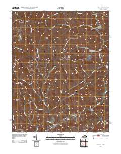
2011 Map of Amonate
USGS Topo · Published 2011About this map
The Tennessee Valley Divide crests through this pocket of the Appalachians, separating the headwaters of numerous creeks and forks. Significant local history is anchored at small settlements like Amonate and Vallscreek, where the Vallscreek Post Office serves as a central landmark for the community. The landscape is defined by its deep hollows and steep ridges, including Kewee Ridge and Big Fork Ridge, which have long dictated the placement of roads and homesteads.
Find a feature on this map
58 named features on this map. Tap any name to fly to it.
Don’t see what you’re looking for? This feature index may not catch every label — zoom into the map to look around manually.
Map Details
Editions of this 2011 Amonate Map
This is the sole edition of this map. No revisions or reprints were ever made.
Other maps of this area

1891 · Tazewell
USGS Topo · 1:125,000

1895 · Tazewell
USGS Topo · 1:125,000

1897 · Tazewell
USGS Topo · 1:125,000

1910 · Iaeger
USGS Topo · 1:48,000

1912 · Pounding Mill
USGS Topo · 1:62,500

1912 · Iaeger
USGS Topo · 1:62,500

1912 · Welch
USGS Topo · 1:62,500

1914 · Iaeger
USGS Topo · 1:48,000

1915 · Richlands
USGS Topo · 1:48,000

1916 · Pounding Mill
USGS Topo · 1:62,500