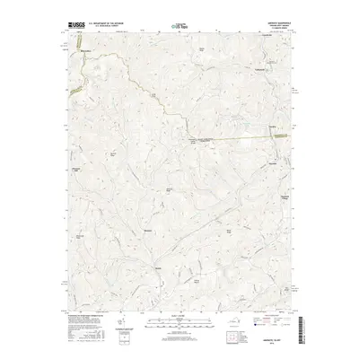
2016 Map of Amonate
USGS Topo · Published 2016About this map
The Tennessee Valley Divide snakes across this high-elevation landscape, marking the border between the watersheds of the William Br and Beech Fork. This terrain, centered on the Virginia and West Virginia state line, is defined by narrow valleys and steep ridges like Whitaker Ridge and Big Fork Ridge. The settlement pattern follows the drainages, with communities such as Amonate and Bandy established along the valley floors. Industrial land use is evident in features like the Vallscreek Slurry Pond, reflecting the region's connection to the Appalachian coal economy. Historic family and community sites are scattered throughout, including the Berwind Cem near Vallscreek and the isolated Stone Steps along the northern heights. Modern infrastructure like State Rte 624 and Amonate Rd connects these settlements through the winding mountain passes.
Find a feature on this map
82 named features on this map. Tap any name to fly to it.
Don’t see what you’re looking for? This feature index may not catch every label — zoom into the map to look around manually.
Map Details
Editions of this 2016 Amonate Map
This is the sole edition of this map. No revisions or reprints were ever made.
Other maps of this area

1891 · Tazewell
USGS Topo · 1:125,000

1895 · Tazewell
USGS Topo · 1:125,000

1897 · Tazewell
USGS Topo · 1:125,000

1910 · Iaeger
USGS Topo · 1:48,000

1912 · Pounding Mill
USGS Topo · 1:62,500

1912 · Iaeger
USGS Topo · 1:62,500

1912 · Welch
USGS Topo · 1:62,500

1914 · Iaeger
USGS Topo · 1:48,000

1915 · Richlands
USGS Topo · 1:48,000

1916 · Pounding Mill
USGS Topo · 1:62,500