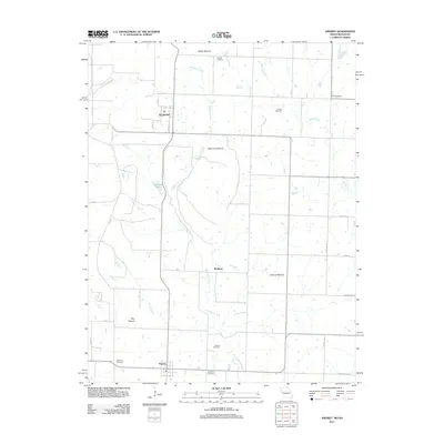
2011 Map of Amoret
USGS Topo · Published 2011About this map
The agricultural plains of western Bates County are defined here by a series of prominent rises including Spy Mound, Summers Mound, and Walley Mound. This Missouri landscape is anchored by the small communities of Amsterdam and Amoret, connected by a grid of rural roads and the north-south drainage of Mulberry Creek. Numerous family and community cemeteries, such as Walley Cemetery and Scott Cemetery, are scattered across the quadrangle, indicating a deep-rooted history of settlement in the region. The inclusion of Railroad Lake suggests the importance of water management and historical infrastructure for the local economy, while the naming of small branches like Willow Branch and Hog Branch reflects the detailed local geography of these Missouri farm lands.
Find a feature on this map
31 named features on this map. Tap any name to fly to it.
Don’t see what you’re looking for? This feature index may not catch every label — zoom into the map to look around manually.
Map Details
Editions of this 2011 Amoret Map
This is the sole edition of this map. No revisions or reprints were ever made.
Other maps of this area

1887 · Butler
USGS Topo · 1:125,000

1887 · Mound City
USGS Topo · 1:125,000

1893 · Mound City
USGS Topo · 1:125,000

1894 · Butler
USGS Topo · 1:125,000

1937 · New Home
USGS Topo · 1:24,000

1938 · Worland
USGS Topo · 1:24,000

1940 · Worland
USGS Topo · 1:24,000

1947 · Lawrence
USGS Topo · 1:250,000

1950 · Lawrence
USGS Topo · 1:250,000

1956 · Lawrence
USGS Topo · 1:250,000