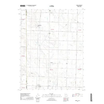
2017 Map of Amoret
USGS Topo · Published 2017About this map
The borderlands of western Missouri and eastern Kansas are defined by a grid of rural roads and scattered family burial grounds in this Bates County survey. The settlement of Amsterdam sits at the crossing of State Hwy Y and State Hwy J, while the village of Amoret anchors the southern portion of the quadrangle. The terrain is marked by distinctive elevations such as Walley Mound, Summers Mound, and Spy Mound, which rise above the drainage basins of Mulberry Creek and Miami Creek.
Find a feature on this map
69 named features on this map. Tap any name to fly to it.
Don’t see what you’re looking for? This feature index may not catch every label — zoom into the map to look around manually.
Map Details
Editions of this 2017 Amoret Map
This is the sole edition of this map. No revisions or reprints were ever made.
Other maps of this area

1887 · Butler
USGS Topo · 1:125,000

1887 · Mound City
USGS Topo · 1:125,000

1893 · Mound City
USGS Topo · 1:125,000

1894 · Butler
USGS Topo · 1:125,000

1937 · New Home
USGS Topo · 1:24,000

1938 · Worland
USGS Topo · 1:24,000

1940 · Worland
USGS Topo · 1:24,000

1947 · Lawrence
USGS Topo · 1:250,000

1950 · Lawrence
USGS Topo · 1:250,000

1956 · Lawrence
USGS Topo · 1:250,000