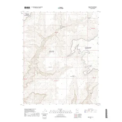
2018 Map of Amos Point
USGS Topo · Published 2018About this map
Grand Canyon National Park and the Lake Mead National Recreation Area converge in this high-desert landscape, defined by dramatic changes in elevation and complex drainage systems. The Sanup Plateau dominates the central terrain, acting as a high tableland where numerous seasonal drainages have carved deep incisions. Steep-walled features like Surprise Canyon, Twin Spring Canyon, and Green Spring Canyon flow northward from the plateau's edge.
Find a feature on this map
18 named features on this map. Tap any name to fly to it.
Don’t see what you’re looking for? This feature index may not catch every label — zoom into the map to look around manually.
Map Details
Editions of this 2018 Amos Point Map
This is the sole edition of this map. No revisions or reprints were ever made.
Other maps of this area

1886 · Diamond Creek
USGS Topo · 1:250,000

1886 · Mt. Trumbull
USGS Topo · 1:250,000

1892 · Diamond Creek
USGS Topo · 1:250,000

1892 · Mt. Trumbull
USGS Topo · 1:250,000

1948 · Williams
USGS Topo · 1:250,000

1953 · Grand Canyon
USGS Topo · 1:250,000

1954 · Williams
USGS Topo · 1:250,000

1956 · Williams
USGS Topo · 1:250,000

1957 · Grand Canyon
USGS Topo · 1:250,000

1958 · Grand Canyon
USGS Topo · 1:250,000