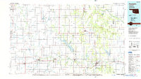
1986 Map of Anadarko
USGS Topo · Published 1986About this map
Anadarko and its surrounding plains are documented here during the mid-1980s, revealing a landscape defined by the winding Washita River and a dense network of county section roads. The map illustrates the region's historical depth, noting the Indian Treaty Boundary and the location of Indian City south of the main settlement. Significant water features like the Fort Cobb Reservoir and Crowder Lake serve as focal points for recreation, alongside Red Rock Canyon State Park near Hinton. The transportation infrastructure of the era is prominently displayed, featuring the routes of the Burlington Northern Railroad and the Atchison, Topeka and Santa Fe Railway, which supported the agricultural and ranching economy of towns like Cordell, Carnegie, and Binger. Scattered landmarks such as Zodletone Mountain and Twin Mounds provide vertical relief in an otherwise expansive terrain of creeks and scattered rural schools and churches.
Find a feature on this map
122 named features on this map. Tap any name to fly to it.
Don’t see what you’re looking for? This feature index may not catch every label — zoom into the map to look around manually.
Map Details
Editions of this 1986 Anadarko Map
2 editions found
Other maps of this area

1892 · Kingfisher
USGS Topo · 1:125,000

1893 · Fort Reno
USGS Topo · 1:62,500

1893 · Buggy Creek
USGS Topo · 1:62,500

1893 · Minco
USGS Topo · 1:62,500

1895 · Kingfisher
USGS Topo · 1:125,000

1902 · Rush Springs
USGS Topo · 1:125,000

1904 · Chickasha
USGS Topo · 1:125,000

1941 · Fort Reno
USGS Topo · 1:62,500

1942 · Fort Reno
USGS Topo · 1:62,500

1942 · Geary
USGS Topo · 1:62,500