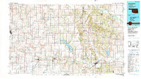
1986 Map of Anadarko
USGS Topo · Published 1990About this map
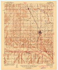
The Washita River and Canadian River valleys define the geography of this mid-1980s landscape, providing the arterial paths for both settlement and transport across several Oklahoma counties. This survey documents a critical period for rural infrastructure, showing the extensive network of the Atchison Topeka and Santa Fe RR and Chicago Rock Island and Pacific RR lines connecting agricultural hubs like Anadarko and Cordell. The map highlights the significant water management and recreation projects of the era, most notably the Fort Cobb Reservoir and its adjacent Fort Cobb State Park. Distinctive geological features such as Rainy Mountain and Ghost Mound provide visual landmarks for those studying the Caddo and Washita county borders. From the canyon floor of Red Rock Canyon State Park to the small-town grids of Cloud Chief and Gotebo, the sheet offers a clear view of Western Oklahoma's transition from early frontier towns to established regional centers.
Find a feature on this map
67 named features on this map. Tap any name to fly to it.
Don’t see what you’re looking for? This feature index may not catch every label — zoom into the map to look around manually.
Map Details
Editions of this 1986 Anadarko Map
2 editions found

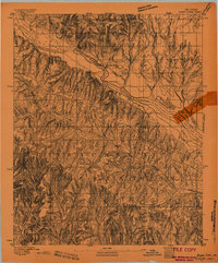
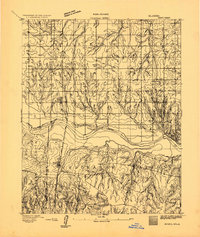
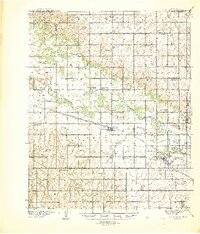
Other maps of this area

1892 · Kingfisher
USGS Topo · 1:125,000

1893 · Fort Reno
USGS Topo · 1:62,500
1893 · Buggy Creek
USGS Topo · 1:62,500
1893 · Minco
USGS Topo · 1:62,500

1895 · Kingfisher
USGS Topo · 1:125,000

1902 · Rush Springs
USGS Topo · 1:125,000

1904 · Chickasha
USGS Topo · 1:125,000
1941 · Fort Reno
USGS Topo · 1:62,500

1942 · Fort Reno
USGS Topo · 1:62,500
1942 · Geary
USGS Topo · 1:62,500