
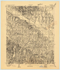
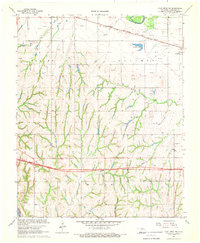
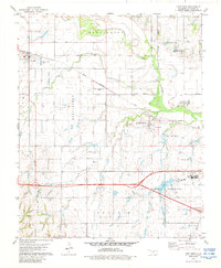
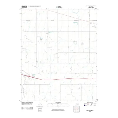
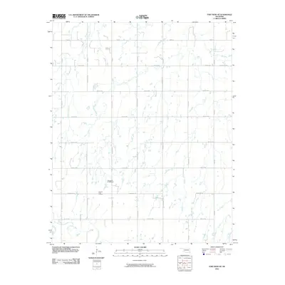
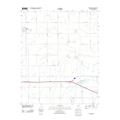
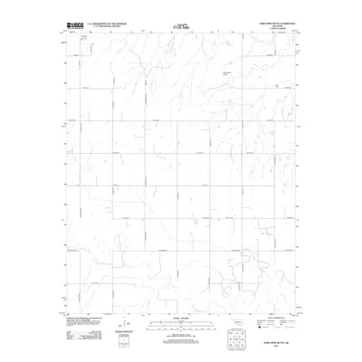
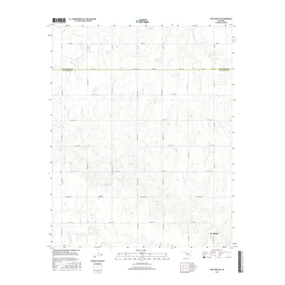
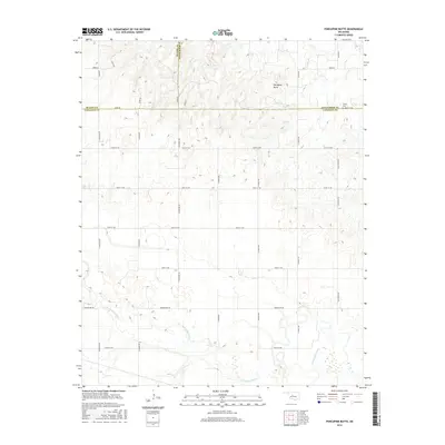
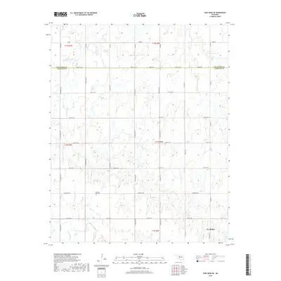
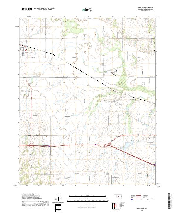
1942 Map of Fort Reno
USGS Topo · Published 1942About this map
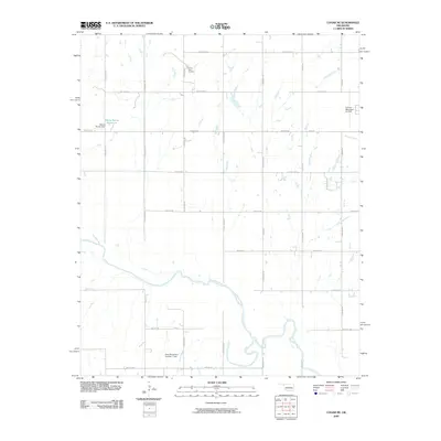
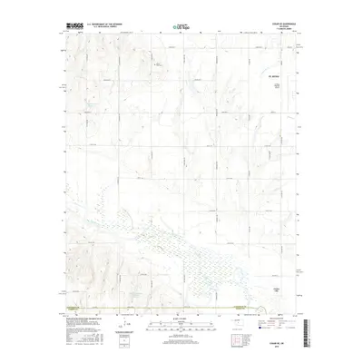
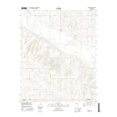
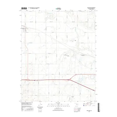
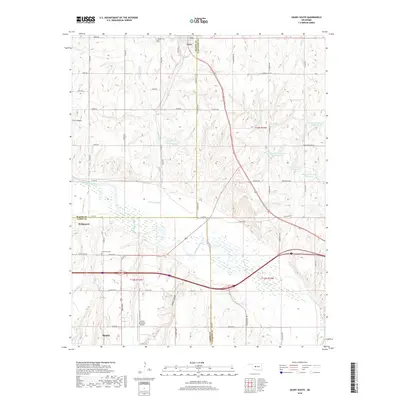
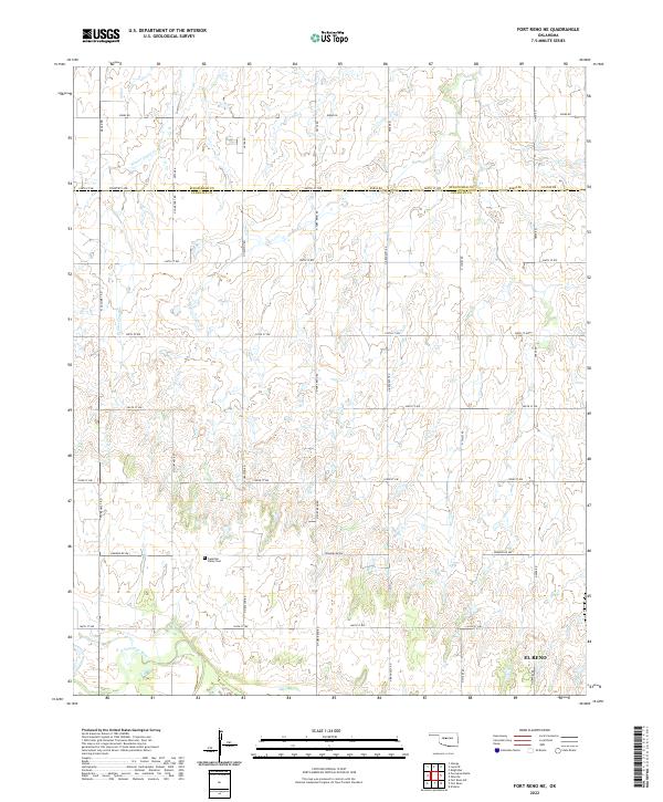
Fort Reno Military Reservation anchors this Central Oklahoma landscape, featuring an extensive Quartermaster Depot and the sprawling Darlington State Game Farm. Surveyed just before the United States entered World War II, the map reveals a dense network of rural infrastructure, including a remarkable concentration of one-room schoolhouses like Cedar Valley Sch and Mound Valley Sch. The North Canadian River winds through the center of the quadrangle, flanked by the Chicago Rock Island and Pacific railroad which services the town of Calumet. Indigenous history is deeply integrated into the settlement pattern, evidenced by the Cheyenne and Arapaho Agricultural School at Concho and multiple religious sites such as the Swappingback Indian Chapel and Cheyenne Arapaho Chapel. Landmarks like Porcupine Butte and The Mound rise above the plains, providing orientation across the agricultural township grids.
Find a feature on this map
47 named features on this map. Tap any name to fly to it.
Don’t see what you’re looking for? This feature index may not catch every label — zoom into the map to look around manually.
Map Details
Editions of this 1942 Fort Reno Map
This is the sole edition of this map. No revisions or reprints were ever made.
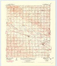
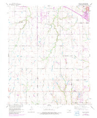
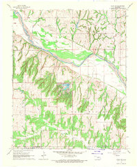
Historical Maps of El Reno Through Time
65 maps found
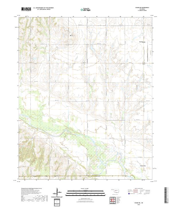
1893 Cogar
Canadian County, OK

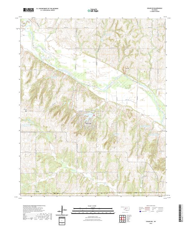
1893 Fort Reno
Canadian County, OK
1941 Fort Reno
Canadian County, OK
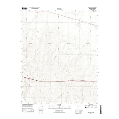
1942 Fort Reno
Canadian County, OK

1949 Fort Reno
Canadian County, OK
1966 Minco NE
Canadian County, OK
1967 Cogar NW
Canadian County, OK
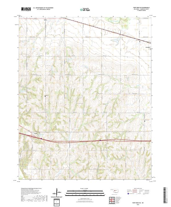
1967 Fort Reno SW
Canadian County, OK
1968 Cogar NE
Canadian County, OK
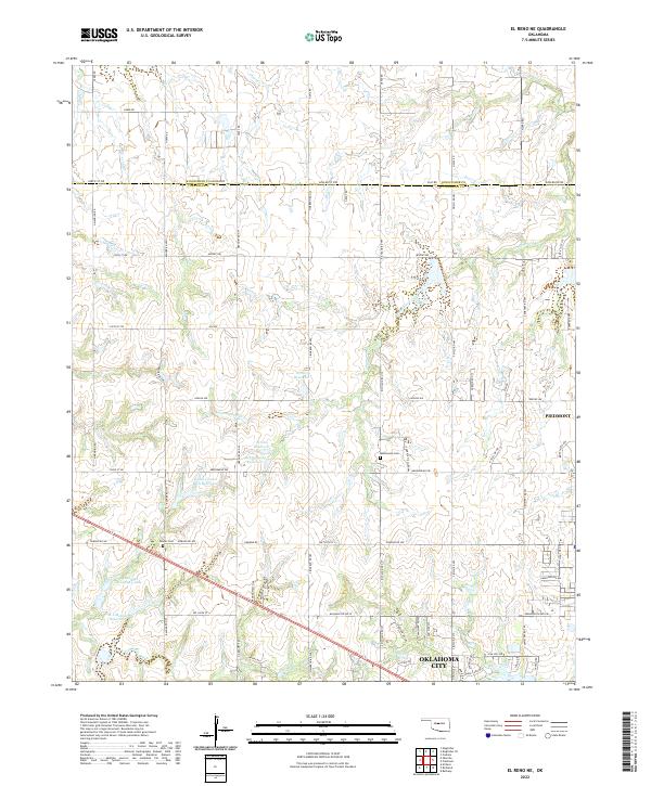
1972 El Reno NE
Canadian County, OK
1972 Richland
Canadian County, OK
1979 Fort Reno
Canadian County, OK
1979 Fort Reno NE
Canadian County, OK
1979 Geary South
Canadian County, OK
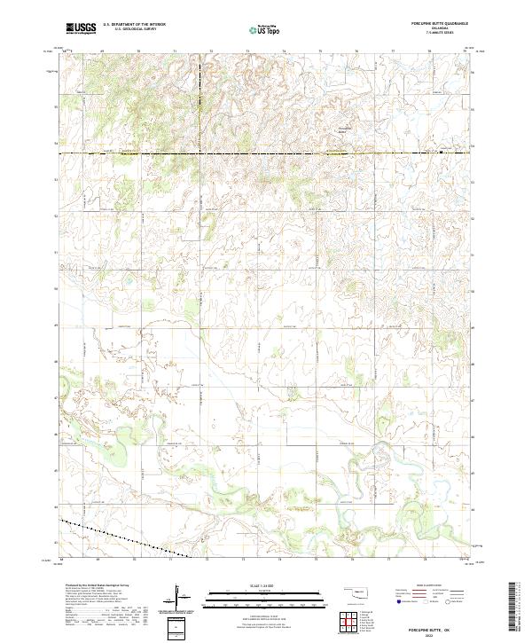
1979 Porcupine Butte
Canadian County, OK
2009 Cogar NE
Canadian County, OK
2009 Cogar NW
Canadian County, OK
2009 El Reno NE
Canadian County, OK
2009 Fort Reno
Canadian County, OK
2009 Fort Reno SW
Canadian County, OK
2009 Minco NE
Canadian County, OK
2009 Porcupine Butte
Canadian County, OK
2009 Richland
Canadian County, OK
2010 Fort Reno NE
Canadian County, OK
2010 Geary South
Canadian County, OK
2012 Cogar NE
Canadian County, OK
2012 Cogar NW
Canadian County, OK
2012 Fort Reno
Canadian County, OK
2012 Fort Reno SW
Canadian County, OK
2012 Geary South
Canadian County, OK
2012 Minco NE
Canadian County, OK
2012 Porcupine Butte
Canadian County, OK
2012 Richland
Canadian County, OK
2013 El Reno NE
Canadian County, OK
2013 Fort Reno NE
Canadian County, OK
2016 Cogar NE
Canadian County, OK
2016 Cogar NW
Canadian County, OK
2016 El Reno NE
Canadian County, OK
2016 Fort Reno
Canadian County, OK
2016 Fort Reno NE
Canadian County, OK
2016 Fort Reno SW
Canadian County, OK
2016 Geary South
Canadian County, OK
2016 Minco NE
Canadian County, OK
2016 Porcupine Butte
Canadian County, OK
2016 Richland
Canadian County, OK
2018 Cogar NE
Canadian County, OK
2018 Cogar NW
Canadian County, OK
2018 El Reno NE
Canadian County, OK
2018 Fort Reno
Canadian County, OK
2018 Fort Reno NE
Canadian County, OK
2018 Fort Reno SW
Canadian County, OK
2018 Geary South
Canadian County, OK
2018 Minco NE
Canadian County, OK
2018 Porcupine Butte
Canadian County, OK
2018 Richland
Canadian County, OK
2022 Cogar NE
Canadian County, OK
2022 Cogar NW
Canadian County, OK
2022 El Reno NE
Canadian County, OK
2022 Fort Reno
Canadian County, OK
2022 Fort Reno NE
Canadian County, OK
2022 Fort Reno SW
Canadian County, OK

2022 Geary South
Canadian County, OK
2022 Minco NE
Canadian County, OK
2022 Porcupine Butte
Canadian County, OK
2022 Richland
Canadian County, OK