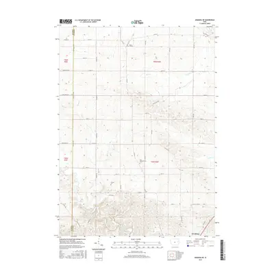
2015 Map of Anamosa NE
USGS Topo · Published 2015About this map
Buffalo Creek winds through the southern reaches of this landscape near Anamosa, providing a central drainage for the rolling agricultural lands of eastern Iowa. The terrain is defined by a dense network of country roads, including Old Cass Rd and Hickory Grove Rd, which trace the section lines of Fairview and Cass townships. For researchers of local history, the placement of several rural burying grounds offers significant genealogical value. Prairie Hill Cem sits in the north along Prairie Hill Rd, while the Cass Congregational Cem and Fremont Cem are situated further south. These sites, along with smaller waterways like Deer Cr and Kitty Cr, mark the long-established rural community boundaries of Jones County and the neighboring Linn Co line.
Find a feature on this map
49 named features on this map. Tap any name to fly to it.
Don’t see what you’re looking for? This feature index may not catch every label — zoom into the map to look around manually.
Map Details
Editions of this 2015 Anamosa NE Map
This is the sole edition of this map. No revisions or reprints were ever made.
Other maps of this area

1890 · Anamosa
USGS Topo · 1:62,500

1891 · Monticello
USGS Topo · 1:62,500

1900 · Anamosa
USGS Topo · 1:125,000

1959 · Dubuque
USGS Topo · 1:250,000

1961 · Dubuque
USGS Topo · 1:250,000

1962 · Dubuque
USGS Topo · 1:250,000

1966 · Hopkinton East
USGS Topo · 1:24,000
1973 · Prairieburg
USGS Topo · 1:24,000
1973 · Springville
USGS Topo · 1:24,000
1973 · Anamosa
USGS Topo · 1:24,000