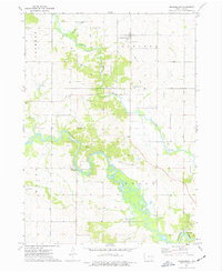
1973 Map of Prairieburg
USGS Topo · Published 1977About this map
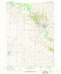
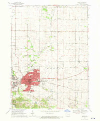
Prairieburg and Waubeek anchor this Linn County landscape, where the Wapsipinicon River and Buffalo Creek converge. The topography of the early 1970s reveals a quiet agricultural region defined by its watercourses and small rural hubs. An Old Railroad Grade cuts through Boulder township, marking the legacy of earlier transportation networks that once connected these dairy-farming communities. Several family and community burial sites, including Prairieburg-Boulder Cem and St Josephs Cem, provide essential data points for genealogical research in this part of eastern Iowa.
Find a feature on this map
21 named features on this map. Tap any name to fly to it.
Don’t see what you’re looking for? This feature index may not catch every label — zoom into the map to look around manually.
Map Details
Editions of this 1973 Prairieburg Map
This is the sole edition of this map. No revisions or reprints were ever made.
Other maps of this area

1888 · Marion
USGS Topo · 1:62,500

1889 · Marion
USGS Topo · 1:62,500

1890 · Anamosa
USGS Topo · 1:62,500

1900 · Anamosa
USGS Topo · 1:125,000

1903 · Winthrop
USGS Topo · 1:125,000

1959 · Dubuque
USGS Topo · 1:250,000

1961 · Dubuque
USGS Topo · 1:250,000

1962 · Dubuque
USGS Topo · 1:250,000
1968 · Central City
USGS Topo · 1:24,000
1968 · Marion
USGS Topo · 1:24,000