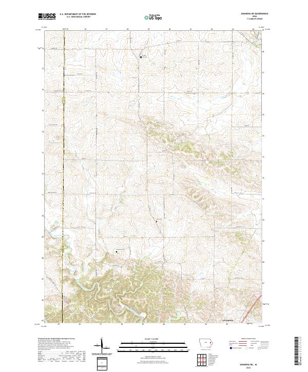
2022 Map of Anamosa NE
USGS Topo · Published 2022About this map
Buffalo Creek winds through the southern landscape of this Jones County region, defining the drainage patterns for a series of smaller tributaries like Helmer Cr and Fawn Cr. The northern outskirts of Anamosa appear at the southern edge, where the transition from town lots to open farmland begins. The terrain is marked by a network of rural roads, including Old Cass Rd and Old Church Rd, which trace the paths of earlier settlement.
Find a feature on this map
48 named features on this map. Tap any name to fly to it.
Don’t see what you’re looking for? This feature index may not catch every label — zoom into the map to look around manually.
Map Details
Editions of this 2022 Anamosa NE Map
This is the sole edition of this map. No revisions or reprints were ever made.
Other maps of this area

1890 · Anamosa
USGS Topo · 1:62,500

1891 · Monticello
USGS Topo · 1:62,500

1900 · Anamosa
USGS Topo · 1:125,000

1959 · Dubuque
USGS Topo · 1:250,000

1961 · Dubuque
USGS Topo · 1:250,000

1962 · Dubuque
USGS Topo · 1:250,000

1966 · Hopkinton East
USGS Topo · 1:24,000
1973 · Prairieburg
USGS Topo · 1:24,000
1973 · Springville
USGS Topo · 1:24,000
1973 · Anamosa
USGS Topo · 1:24,000