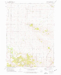
1973 Map of Anamosa NE
USGS Topo · Published 1977About this map
Agricultural lands and rolling stream valleys define this northeast corner of Jones County in the early 1970s. The landscape is bisected by the winding course of Buffalo Creek and Deer Creek, showing a pattern of dispersed rural settlement centered around local community hubs. Townhall and the Cass Center Ch serve the southern townships, while the northern boundary features SS Peter & Paul Ch and the adjacent Prairie Hill Cem.
Find a feature on this map
16 named features on this map. Tap any name to fly to it.
Don’t see what you’re looking for? This feature index may not catch every label — zoom into the map to look around manually.
Map Details
Editions of this 1973 Anamosa NE Map
This is the sole edition of this map. No revisions or reprints were ever made.
Other maps of this area

1890 · Anamosa
USGS Topo · 1:62,500

1891 · Monticello
USGS Topo · 1:62,500

1900 · Anamosa
USGS Topo · 1:125,000

1959 · Dubuque
USGS Topo · 1:250,000

1961 · Dubuque
USGS Topo · 1:250,000

1962 · Dubuque
USGS Topo · 1:250,000

1966 · Hopkinton East
USGS Topo · 1:24,000
1973 · Prairieburg
USGS Topo · 1:24,000
1973 · Springville
USGS Topo · 1:24,000
1973 · Anamosa
USGS Topo · 1:24,000