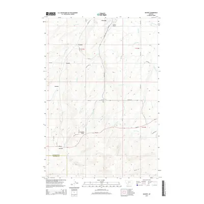
2014 Map of Anceney
USGS Topo · Published 2014About this map
Anceney sits at the southwestern edge of this landscape where the Gallatin Co Madison Co line meets. The area is defined by a sophisticated water management network essential for high-plains agriculture, featuring the Highline Canal, Lowline Canal, and various systems like the Valley Ditch and Keughen Ditch. Small agricultural settlements including Churchill, Westlake, Arnold, and Vincent are connected by a grid of named rural roads such as Norris Rd and Churchill Rd. The terrain transitions from the open flats into the more pronounced relief of Godfrey Canyon. For genealogists, the Little Holland Cem Hills Cem serves as a vital point of interest, marking a historical focal point for the families who settled this region between the Camp Cr and Godfrey Cr drainages.
Find a feature on this map
42 named features on this map. Tap any name to fly to it.
Don’t see what you’re looking for? This feature index may not catch every label — zoom into the map to look around manually.
Map Details
Editions of this 2014 Anceney Map
This is the sole edition of this map. No revisions or reprints were ever made.
Other maps of this area

1888 · Three Forks
USGS Topo · 1:250,000

1894 · Three Forks
USGS Topo · 1:250,000

1895 · Three Forks
USGS Topo · 1:250,000

1947 · Bozeman
USGS Topo · 1:250,000

1948 · Bozeman
USGS Topo · 1:250,000

1949 · Anceney
USGS Topo · 1:62,500

1949 · Manhattan
USGS Topo · 1:62,500

1950 · Belgrade
USGS Topo · 1:62,500

1953 · Bozeman
USGS Topo · 1:62,500

1955 · Bozeman
USGS Topo · 1:250,000