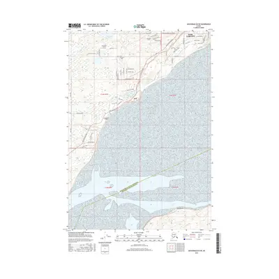
2016 Map of Anchorage B-8 NE
USGS Topo · Published 2016About this map
The settlement of Knik stands at the edge of the Knik Arm, where the landscape transitions from the waters of the inlet to a terrain dotted with small lakes and aviation infrastructure. This 2016 survey highlights a unique Alaskan residential pattern, where private airfields like Birchwater Airport, Lawrence Airstrip, and the Huttunen Strip are integrated directly into the local road network. The map reveals the expansion of Knik-Fairview, showing a dense grid of named streets such as Knik Knack Mud Shack Road and Trimotor Street that push into the surrounding wilderness. Interior water bodies including Threemile Lake, Knik Lake, and Caves Lake are central landmarks for the community, while Fish Cr drains toward the coast. The southern portion of the sheet is defined by the vast tidal flats and the boundary between the Matanuska-Susitna Borough and Anchorage Municipality.
Find a feature on this map
63 named features on this map. Tap any name to fly to it.
Don’t see what you’re looking for? This feature index may not catch every label — zoom into the map to look around manually.
Map Details
Editions of this 2016 Anchorage B-8 NE Map
This is the sole edition of this map. No revisions or reprints were ever made.
Other maps of this area

1950 · Anchorage C-8
USGS Topo · 1:63,360

1950 · Anchorage C-7
USGS Topo · 1:63,360

1951 · Anchorage
USGS Topo · 1:250,000

1951 · Anchorage C-7
USGS Topo · 1:63,360

1952 · Anchorage C-7
USGS Topo · 1:63,360

1952 · Anchorage C-8
USGS Topo · 1:63,360

1952 · Anchorage B-8
USGS Topo · 1:63,360

1953 · Anchorage B-8
USGS Topo · 1:63,360

1960 · Anchorage B-7
USGS Topo · 1:63,360

1962 · Anchorage
USGS Topo · 1:250,000