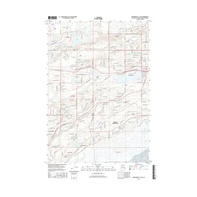
2016 Map of Anchorage C-7 SW
USGS Topo · Published 2016About this map
Wasilla and the surrounding Matanuska-Susitna Valley are defined by a complex network of glacial lakes and residential expansion in this 2016 survey. The map details the transition from the concentrated commercial and transit hub of Wasilla, centered around Lucile Lake, to the rapidly developing suburban landscape of Knik-Fairview. Numerous private airstrips and small landings, such as Hess Airport, Piper Landing, and Kalmbach Airport, illustrate the unique aviation-dependent infrastructure of the Alaskan interior. Local history is anchored at the Wasilla Aurora Cem, while the natural drainage of Cottonwood Creek and Lucile Creek dictates the layout of the various subdivisions and roads. The southern portion of the sheet shows the settlement of Cottonwood and the winding course of Cottonwood Slough, providing a clear record of the area's hydrology and modern settlement patterns just before recent growth further altered the terrain.
Find a feature on this map
235 named features on this map. Tap any name to fly to it.
Don’t see what you’re looking for? This feature index may not catch every label — zoom into the map to look around manually.
Map Details
Editions of this 2016 Anchorage C-7 SW Map
This is the sole edition of this map. No revisions or reprints were ever made.
Other maps of this area

1950 · Anchorage C-8
USGS Topo · 1:63,360

1950 · Anchorage C-7
USGS Topo · 1:63,360

1951 · Anchorage
USGS Topo · 1:250,000

1951 · Anchorage C-7
USGS Topo · 1:63,360

1952 · Anchorage C-7
USGS Topo · 1:63,360

1952 · Anchorage C-8
USGS Topo · 1:63,360

1952 · Anchorage B-8
USGS Topo · 1:63,360

1953 · Anchorage B-8
USGS Topo · 1:63,360

1960 · Anchorage B-7
USGS Topo · 1:63,360

1962 · Anchorage
USGS Topo · 1:250,000