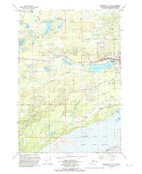
1992 Map of Anchorage C-7 SW
USGS Topo · Published 1992About this map
Wasilla serves as the focal point of this 1990s study, situated just north of the expansive Lake Lucile. The landscape reflects a period of significant suburban development and institutional growth in the Matanuska-Susitna Valley, evidenced by the presence of Iditarod Sch, Tanaina Sch, and Snowshoe Sch. Transportation networks like the George Parks Highway and Knik Goose Bay Road anchor the settlement patterns, while the southern reaches of the map transition into the marshy lowlands of the Palmer Hay Flats and the protected State Game Refuge.
Find a feature on this map
55 named features on this map. Tap any name to fly to it.
Don’t see what you’re looking for? This feature index may not catch every label — zoom into the map to look around manually.
Map Details
Editions of this 1992 Anchorage C-7 SW Map
This is the sole edition of this map. No revisions or reprints were ever made.
Other maps of this area

1950 · Anchorage C-8
USGS Topo · 1:63,360

1950 · Anchorage C-7
USGS Topo · 1:63,360

1951 · Anchorage
USGS Topo · 1:250,000

1951 · Anchorage C-7
USGS Topo · 1:63,360

1952 · Anchorage C-7
USGS Topo · 1:63,360

1952 · Anchorage C-8
USGS Topo · 1:63,360

1952 · Anchorage B-8
USGS Topo · 1:63,360

1953 · Anchorage B-8
USGS Topo · 1:63,360

1960 · Anchorage B-7
USGS Topo · 1:63,360

1962 · Anchorage
USGS Topo · 1:250,000