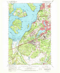
1959 Map of Anderson Island
USGS Topo · Published 1968About this map
Fort Lewis Military Reservation and the sprawling Mcchord Air Force Base dominate the landscape south of Tacoma in the late 1950s. This survey illustrates a region defined by massive federal and state institutional footprints, from the Federal Penitentiary on McNeil Island to the State Hospital near Steilacoom Lake. The residential growth of the era is evident in the emerging suburban grids of University Place, Fircrest, and Lakewood Center, which contrast sharply with the undeveloped Nisqually Flats.
Find a feature on this map
119 named features on this map. Tap any name to fly to it.
Don’t see what you’re looking for? This feature index may not catch every label — zoom into the map to look around manually.
Map Details
Editions of this 1959 Anderson Island Map
This is the sole edition of this map. No revisions or reprints were ever made.
Other maps of this area

1897 · Tacoma
USGS Topo · 1:125,000

1900 · Tacoma
USGS Topo · 1:125,000

1916 · Chehalis
USGS Topo · 1:125,000

1937 · Olympia
USGS Topo · 1:62,500

1937 · Eatonville
USGS Topo · 1:125,000

1938 · Allyn
USGS Topo · 1:62,500

1940 · Tenino
USGS Topo · 1:62,500

1940 · Anderson Island
USGS Topo · 1:62,500

1941 · Tanwax Lake
USGS Topo · 1:62,500

1941 · Tacoma South
USGS Topo · 1:62,500